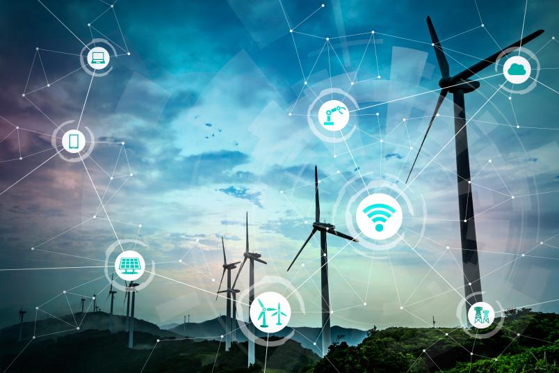
The world and Europe in particular are currently facing an Energy Transition that will substantially change the energy systems. Some of the main key drivers are the crucial and growing role played by electricity in the energy sector, wide integration of distributed renewable sources, increasing accessibility to cheap and efficient ICT systems, and active participation of end consumers. In this context, traditional power grids have been rapidly moving towards smart grids to provide efficient, reliable, secure, and high-quality energy generation, transmission, and consumption.
A modern communication infrastructure with intelligent electronic devices is required to manage, control, and optimize these emerging electric energy systems. The course "Smart grids" shows how ICT practically provides the capability to support bidirectional energy and information flow, self-healing actions to quickly restore systems during faults or outages, facilitate renewable energy resource integration into the grid, and involving energy consumers in optimal energy management.
New ICT approaches (e.g. Internet of Things) or concepts (e.g. Internet of Energy) are being applied to more efficiently link the physical layer of the energy system with the function and operation layer to achieve desired business objectives.
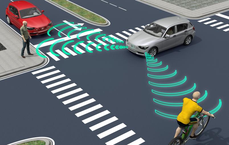
Intelligent Transport Systems (ITS) improve the effectiveness and efficiency of transportation systems through the usage of advanced information and communication technologies. These ICT technologies offer the ability to collect, process, and extract useful information from raw mobility data, allowing us to optimise mobility, help in reducing traffic congestion, offer alternate transport means, reduce pollution, and in general improve the quality of life in smart cities.
The course "ICT for smart mobility" is focused on giving the students a data science approach to transport engineering. The course covers the performance, modelling, control, and management of transportation systems and the deployment of advanced ICT systems and their analysis.
The course has a mix of theoretical lessons and practical activities using real data and specific case studies to let the students solve practical problems.
ICT knowledge and applications enable a better use of resources in buildings hence allowing for optimising building indoor environmental quality while reducing energy needs during both building design and building intelligent operational phases, helping cities to reduce their carbon emissions. In the course “Intelligent building optimisation”, we address this challenge, dealing with the integration of building systems, technology and energy systems within a smart control environment.
This is done by describing building components and related technical systems, as well as digital architecture, climate-responsive building envelope, and kinetic façade. In this context, ICT is used for smart control of heating, ventilation, and air conditioning systems in order to provide thermal comfort and control air quality and illumination. White box models are adopted together with grey and black box ones to support the development of digital twins and optimise both building design envelope choices via surrogate modelling and building operational actions. The latter is performed by simulating an intelligent building management system able to automatically set, by means of control algorithms, building-related actuation parameters on the basis of measured real-time data exploiting innovative approaches of the use of digital twins and advanced building modelling solutions.
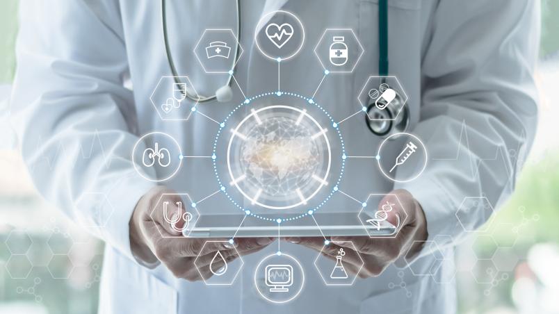
Public health is the most important pillar needed to provide a high level of quality of life to citizens. In addition to the conventional medical approach, in the last few years new technologies have become more and more widespread, and are changing the way in which patients and doctors interact to provide medical services. In particular, ICT has become prevalent, as communication and data analysis technologies can be of great help in the medical field. Health can benefit from ICT in many ways.
Remote medical analysis can be performed via telemedicine, exploiting communications and data compression. New medical devices are being developed, which exploit sensors and cameras to gather information, and process this information to infer parameters describing the health conditions of an individual.
Processing can be performed on personal devices such as smartphones, opening the way to a host of new medical services. In this sense, ICT is enabling new access modalities to medical services, which allow a larger number of individuals (e.g., elderly people) to benefit from them.
The course “Machine learning for health” addresses many of these issues, describing e-health, m-health, and telemedicine applications, as well as supervised/unsupervised machine learning techniques applied to specific health problems, with a hands-on approach.
In today’s world, satellite technologies are transforming the fields of positioning and mapping by delivering advanced data products that are essential in our smart communities. Global Navigation Satellite Systems (GNSS), such as GPS, GLONASS, and Galileo, have become indispensable tools for determining precise user locations and understanding movement patterns.
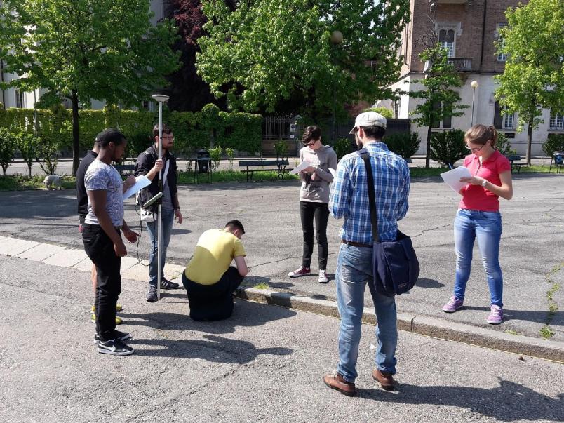
Modern smart devices now incorporate GNSS technology along with inertial platforms, digital and thermal cameras, and sophisticated communication interfaces, which together offer powerful tools for data collection and processing. In the course “Satellite systems for positioning and maps”, we explore the foundations of GNSS with a focus on receiver architecture and signal processing. Students learn how these receivers function, how they are designed, and how to analyze and interpret the data they provide through hands-on laboratory sessions.
GNSS receivers serve as a cornerstone for mapping applications, and in the second part of the course, these applications are further examined alongside Geographic Information Systems (GIS). Through practical, on-field labs, students gain experience with positioning technologies in both static and dynamic environments. They learn various methodologies, approaches, and techniques, including conducting a full-scale field survey, equipping them with practical skills for real-world applications.
This course offers an exciting, in-depth look at the satellite technologies shaping our future, blending theoretical insights with essential hands-on training.